2022-06-06 バッファロー大学(UB)
世界の森林生態系の迅速かつ正確なインベントリー作成に向けた画期的な開発であり、森林火災の防止、病気の検出、正確な炭素計測、情報に基づいた森林管理の意思決定などの能力を向上させることができます。
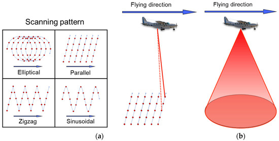
この技術は、有人飛行機、無人ドローン、バックパック搭載のシステムを使用します。このシステムは、光検出・測距装置(LiDAR)を備えたカメラと、統合型グローバルナビゲーション衛星システム(GNSS)および慣性航法システム(INS)を含むナビゲーションセンサーを統合しています。
<関連情報>
- https://www.purdue.edu/newsroom/releases/2022/Q2/integration-leads-to-leap-in-tech-for-forest-inventory,-management.html
- https://www.mdpi.com/2072-4292/14/3/649?_ga=2.34344097.1605294786.1654567752-828432578.1646956741
森林インベントリのためのマルチプラットフォーム、マルチ解像度、多時刻LiDARデータの比較解析 Comparative Analysis of Multi-Platform, Multi-Resolution, Multi-Temporal LiDAR Data for Forest Inventory
Yi-Chun Lin,Jinyuan Shao,Sang-Yeop Shin,Zainab Saka,Mina Joseph,Raja Manish,Songlin Fei and Ayman Habib
Remote Sensing Published: 29 January 2022
DOI: https://doi.org/10.3390/rs14030649

Abstract
LiDAR technology is rapidly evolving as various new systems emerge, providing unprecedented data to characterize forest vertical structure. Data from different LiDAR systems present distinct characteristics owing to a combined effect of sensor specifications, data acquisition strategies, as well as forest conditions such as tree density and canopy cover. Comparative analysis of multi-platform, multi-resolution, and multi-temporal LiDAR data provides guidelines for selecting appropriate LiDAR systems and data processing tools for different research questions, and thus is of crucial importance. This study presents a comprehensive comparison of point clouds from four systems, linear and Geiger-mode LiDAR from manned aircraft and multi-beam LiDAR on unmanned aerial vehicle (UAV), and in-house developed Backpack, with the consideration of different forest canopy cover scenarios. The results suggest that the proximal Backpack LiDAR can provide the finest level of information, followed by UAV LiDAR, Geiger-mode LiDAR, and linear LiDAR. The emerging Geiger-mode LiDAR can capture a significantly higher level of detail while operating at a higher altitude as compared to the traditional linear LiDAR. The results also show: (1) canopy cover percentage has a critical impact on the ability of aerial and terrestrial systems to acquire information corresponding to the lower and upper portions of the tree canopy, respectively; (2) all the systems can obtain adequate ground points for digital terrain model generation irrespective of canopy cover conditions; and (3) point clouds from different systems are in agreement within a ±3 cm and ±7 cm range along the vertical and planimetric directions, respectively.


