
2026-09-11 スイス連邦工科大学ローザンヌ校(EPFL)
<関連情報>
- https://actu.epfl.ch/news/satellite-imagery-gives-experts-a-better-understan/
- https://www.nature.com/articles/s41586-026-11004-6
衛星データを用いた紛争研究と対応の推進 Advancing conflict research and response through satellite-derived data
Valerie Sticher,Corinne Bara,Jenniina Kotajoki,Lars Bromley,Thierry Crevoisier,Emanuele Dalsasso,Olivier Dietrich,Karsten Donnay,Filip Dorm,Manuel Fiol,Xi Li,Mikael Hiberg Naghizadeh,Corey Scher,Jamon Van Den Hoek,Konrad Schindler,Devis Tuia & Jan Dirk Wegner
Nature Published:09 September 2026
DOI:https://doi.org/10.1038/s41586-026-11004-6
Abstract
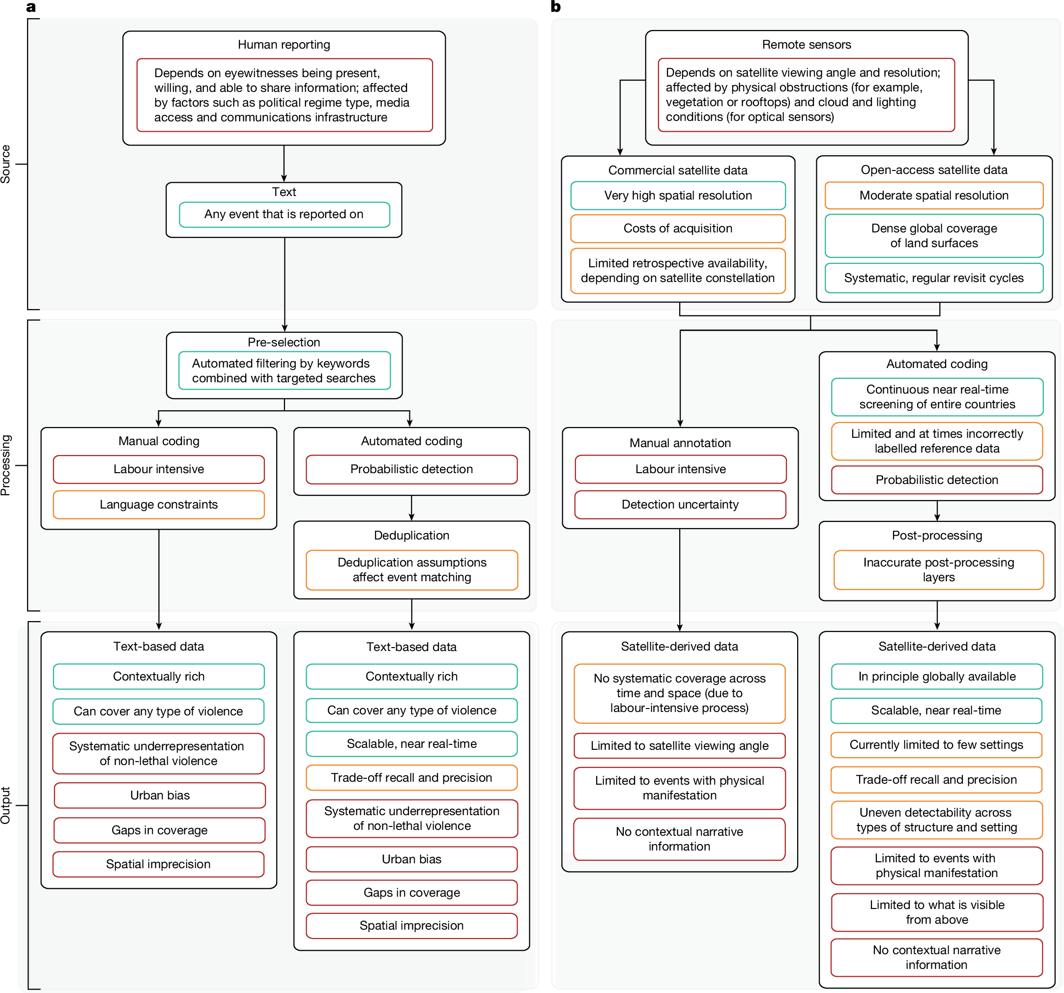
With armed conflicts at a historic high and attacks on civilians rising1, understanding the evolving nature of conflict is a critical research priority. The current paradigm in conflict research relies heavily on text-based data, using fatalities as the primary—and often sole—proxy for violence intensity. Although these data have expanded our ability to study armed conflict, they exhibit inherent limitations due to uneven human reporting2,3,4,5,6. War damage assessments based on satellite data7,8,9,10,11,12,13 offer a complementary perspective. Satellite-derived data have their own limitations, but these arise from different mechanisms, creating distinct, complementary strengths that can be leveraged through data integration. Here we propose three concrete approaches to integration: improvement, enrichment and fusion. Each bridges a different gap in the underlying data sources. We use case studies from Ukraine and Myanmar to illustrate how integration can be implemented in practice and the novel analytical insights that emerge. Prioritizing data integration enables a paradigm shift away from fatality-centric research towards a broader spectrum of violence, revealing the complexity of conflict dynamics.

