2024-03-05 NASA
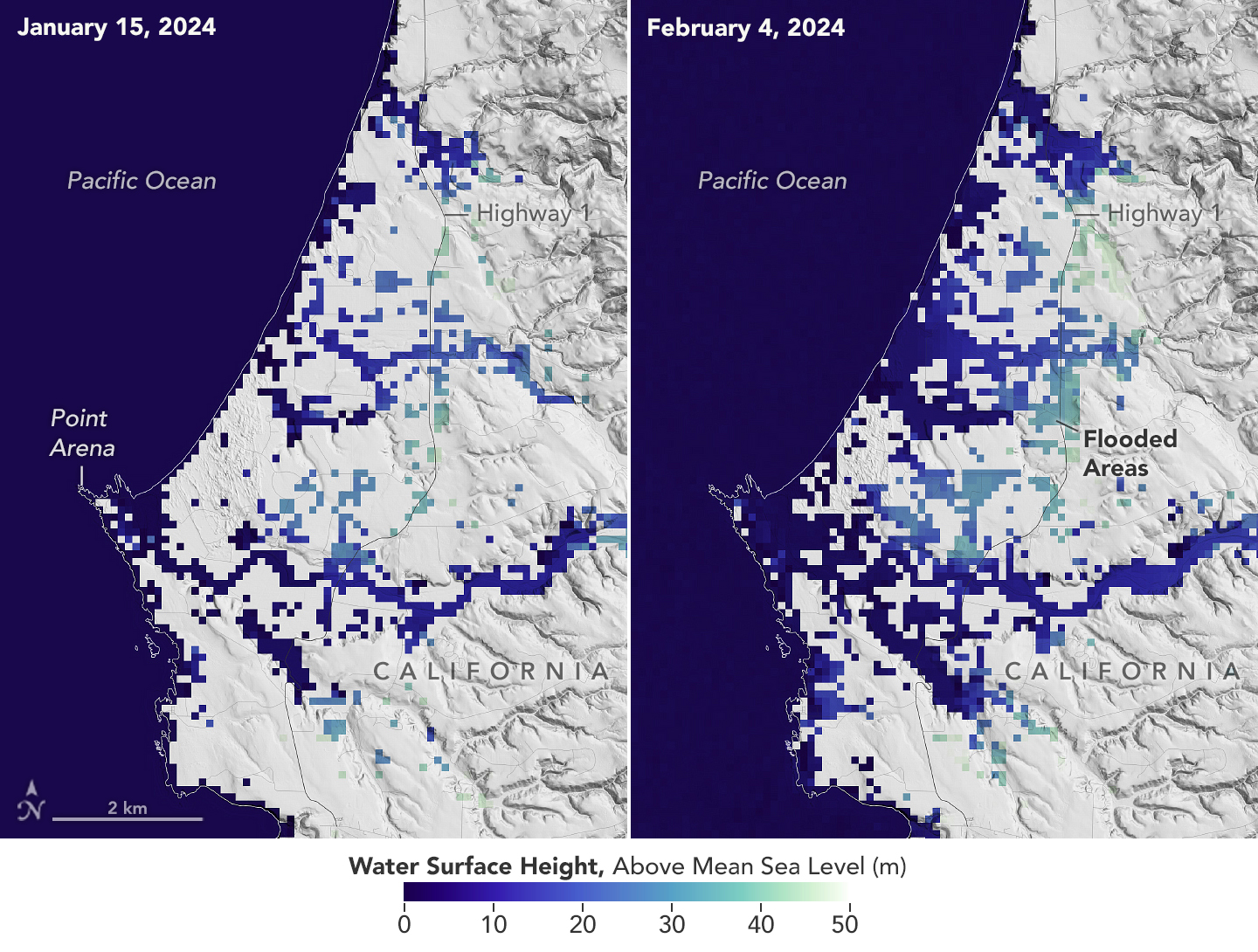
 This image shows SWOT satellite data for water surface height in part of Mendocino County, Northern California, on Jan. 15, before several atmospheric rivers arrived, and on Feb. 4, after the first storms. Light blue and green indicate the highest water levels relative to mean sea level. (Inland water heights include the underlying ground elevation.)
NASA/JPL-Caltech
NASAとフランス宇宙機関が運営するSurface Water and Ocean Topography(SWOT)ミッションは、陸地、海岸、海洋の水について新しい視点を提供しています。SWOTミッションは、大気の川が2月にカリフォルニアを豪雨で覆い、一部地域では過去最高の雨量とハリケーン並みの風が吹き荒れたことを記録しました。カリフォルニア州のほぼ全体で洪水警報が発令される事態となりました。SWOTミッションは、NASAとフランス宇宙機関CNESの共同プロジェクトであり、洪水による影響をキャプチャーしました。SWOTは、2022年12月以来、地球表面のほぼすべての水位を測定し、惑星の海洋や淡水湖、川の最も詳細で包括的な景色の一つを開発しています。
<関連情報>


