ドローンと熱赤外線画像を使って、UMASS Amherstの研究者が湿地帯の最適な復元方法を示し、マサチューセッツ州が健全な生態系への取り組みをリードしている理由を明らかにしました。 Using drones and thermal infrared imagery, UMass Amherst researchers show how best to restore wetlands—and why Massachusetts is leading the charge toward healthy ecosystems
2023-02-06 マサチューセッツ大学アマースト校
◆マサチューセッツ州東部は、何世代にもわたって米国におけるクランベリー栽培の発祥地であり、現在、14,000エーカー以上の面積で栽培されています。クランベリーは、氷河期の遺産である酸性の泥炭湿地に生育している。1800年代半ばにクランベリーの商業栽培を始めたヨーロッパ系アメリカ人は、収穫量を増やすために自然の淡水湿地帯を大幅に改変して、クランベリーの栽培を開始した。
◆ハッチは、かつて湿地であった場所を復元することは、ゼロから新しい湿地を作るより簡単だと述べていますが、それでも150年にわたる造園を元に戻すことは非常に複雑な作業です。湿地の復元とは、地下水を農業以前のゆっくりとした流速に戻し、その水を保持することです。
◆地下水の動きを追跡し、測定するために、ハッチは大学院生のリン・ワッツ(地下水のマッピングに関する論文の主執筆者)と、UMass AmherstのUMassAirの共著者ライアン・ウィックスとともに、2020年と2021年の真冬の未明の時間に空へ飛びました。
◆ドローンパイロットのエースであるワッツは、熱を見ることができる赤外線カメラを搭載したUAVを飛ばした。地下水は年間を通じてほぼ一定の温度を保っているため、凍った地表水よりも温かい地下水がクランベリー湿地の中をどのように移動しているかを「見る」ことができ、調査地の湿地システム全体における地下水の流れも把握することができました。
◆その結果、地下水は農業以前の湿地帯と同じように、復元された湿地帯をより長い時間かけて移動し、この滞留時間の増加によって、湿地帯が地表に溜まるほどの水で「満たされる」ことが分かりました。
<関連情報>
- https://www.umass.edu/news/article/how-rewild-wetland-hint-focus-groundwater
- https://www.frontiersin.org/articles/10.3389/fenvs.2022.946565/full
湿地再生地におけるUAS熱画像による地下水排出湧出域のマッピング Mapping groundwater discharge seeps by thermal UAS imaging on a wetland restoration site
C. Lyn Watts, Christine E. Hatch and Ryan Wicks
Frontiers in Environmental Science Published:01 February 2023
DOI:https://doi.org/10.3389/fenvs.2022.946565

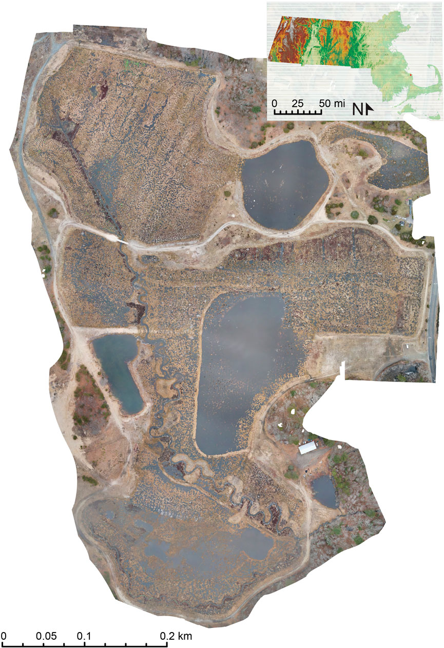
One of the key metrics for the effectiveness of wetland restoration is whether a restored wetland behaves hydrologically like a natural wetland. Restoration is designed to increase the water residence time on the surface of the site in order to capture and process nutrients, mitigate the impact of local flooding and drought, and provide a habitat for wetland species abundance and biodiversity. Quantifying the change in groundwater presence at the wetland’s surface will inform future freshwater wetland restorations across New England. The ability to produce a comprehensive map of the locations of groundwater discharge over a large area has the potential to provide insight into restoration practice, its success, and its effects on individual seeps over time. Identification, mapping, and measurement of groundwater discharge sites have long been a challenge, but new methodologies are developing with the advances in unmanned aerial systems (UAS). This study uses a UAS-mounted thermal infrared camera to map groundwater seeps on a 25-ha (62-acre) site in Plymouth, Massachusetts, before and after it underwent restoration to a freshwater wetland. Using the thermal map, we located and quantified the spatial extent that of groundwater seeps pre-restoration and the changes after restoration. The location and size of these seeps show that existing groundwater seeps remained immobile through restoration, but their surface expression grew, indicating that restoration removed barriers to surface expression and successfully increased residence time. This analysis using a thermal camera-enabled UAS allows for a temporal comparison over large spatial scales and provides insight into restoration impacts to groundwater expression on the surface of post-agricultural wetland sites.


