2026-07-19 中国科学院(CAS)
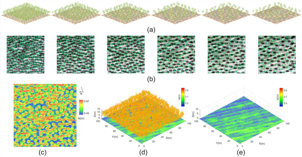
NDVI distributions derived from the hyperspectral imagery, and from the HSL point cloud before and after filtering. (Image by AIR)
<関連情報>
- https://english.cas.cn/newsroom/research-news/202607/t20260720_1178696.shtml
- https://www.sciencedirect.com/science/article/abs/pii/S0034425726002610
下層土壌のスペクトル取得と特性推定におけるハイパースペクトルLiDARの能力評価 Assessing hyperspectral LiDAR capability for understory soil spectral retrieval and property estimation
Yishuo Hao, Li Wang, Zheng Niu, Yunsheng Dong, Jianying Liu, Guoxu Li, Chang Liu, Jie Bai, Kaiyi Bi
Remote Sensing of Environment Available online: 22 May 2026
DOI:https://doi.org/10.1016/j.rse.2026.115491
Highlights
- The potential of HSL for understory soil detection is evaluated using 3D RTM.
- HSL reduces canopy scattering interference more effectively than passive imaging.
- HSL shows potential for estimating soil organic carbon and total nitrogen content.
Abstract
Continuous soil monitoring is crucial for agricultural and forestry management and for understanding ecosystem health. However, vegetation canopy limits passive remote sensing in capturing understory soil spectral signatures. The recently developed hyperspectral LiDAR (HSL) technology, capable of providing spectral information at distinct geometric positions, offers new possibilities for understory soil detection. In this study, 3D vegetation-soil scenes were constructed using field measured soil hyperspectral data and customized tree models. The LESS radiative transfer model was employed to simulate HSL point clouds and hyperspectral imagery (HI) under varying vegetation coverage levels. The potential for understory soil spectral retrieval was evaluated from three aspects: radiance intensity, spectral curves, and spectral indices. Results demonstrate that laser pulse echoes are substantially less susceptible to canopy multiple scattering interference compared to passive imaging. Retrieved soil spectral curves exhibited markedly improved fidelity, with mean spectral angles decreasing from >2.3° for HI to<0.2° for HSL. Spectral indices showed stronger consistency with reference spectra, with R2 values increasing from 0.49 for HI to >0.83 for HSL. Furthermore, HSL-derived spectral information demonstrated promising potential for soil property estimation, achieving R2 of 0.332 for soil organic carbon (SOC) and 0.485 for total nitrogen (TN) through partial least squares regression modeling. This study demonstrates that HSL is a promising approach for soil monitoring in vegetated areas without requiring extensive bare soil exposure windows.