2024-04-15 NASA
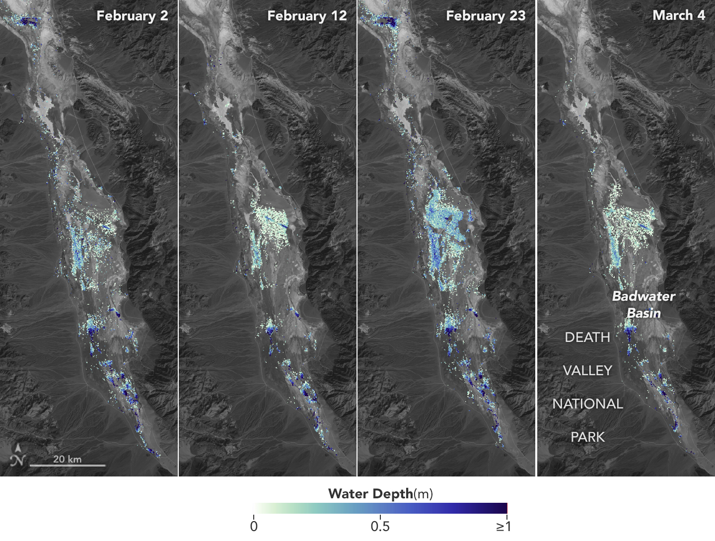
 Water depths in Death Valley’s temporary lake ranged between about 3 feet (or 1 meter, shown in dark blue) to less than 1.5 feet (0.5 meters, light yellow) from February through early March. By measuring water levels from space, SWOT enabled research to calculate the depth.
NASA/JPL-Caltech
NASA主導の分析により、国際表面水体・海洋地形ミッションのデータが、デスバレーの一時的な淡水域の水深を計算するのに役立ちました。デスバレー、北米で最も乾燥した場所の一つに、2023年末から一時的な湖が存在しています。2024年2月と3月の数週間にわたり、SWOT衛星によって湖の水深が計算され、その能力が実証されました。水深は、約6週間にわたり1メートルから0.5メートル未満に及び、記録的な降雨がカリフォルニア全体に及んだ一連の嵐によって影響を受けました。
<関連情報>


