
")
2025-04-03 中国科学院(CAS)
<関連情報>
- https://english.cas.cn/newsroom/research_news/tech/202504/t20250407_909497.shtml
- https://ieeexplore.ieee.org/document/10878476
Tianwen-1火星探査ミッションにおけるZhurongローバーのビジュアルローカライゼーションと地形マッピング Visual Localization and Topographic Mapping for Zhurong Rover in Tianwen-1 Mars Mission
Wenhui Wan; Jia Wang; Zhaoqin Liu; Kaichang Di; Man Peng; Yexin Wang;…
IEEE Journal of Selected Topics in Applied Earth Observations and Remote Sensing Published:10 February 2025
DOI:https://doi.org/10.1109/JSTARS.2025.3540377
Abstract
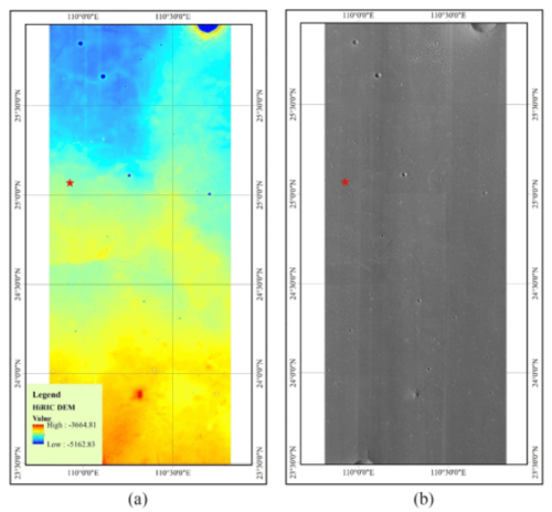
This article presents the methods, results, and applications of visual localization and topographic mapping for the Zhurong rover in China’s Tianwen-1 Mars mission. New techniques, namely vignette correction and online camera mast calibration, were developed for the images captured by the rover’s navigation and terrain cameras (NaTeCam) to enhance the mapping qualities. During surface operations, photogrammetric techniques were routinely applied at the traveling waypoints. The NaTeCam images were obtained to generate 3-D topographic mapping products at the centimeter level to support obstacle analysis and rover path planning. Cross-site visual localization at adjacent waypoints was conducted to reduce the accumulated position errors in the onboard dead-reckoning result. Visual localization refinement was also employed by matching the digital orthophoto map (DOM) from the rover images and the orbital basemap at waypoints where distinct terrain features were available to further eliminate the localization errors. Compared with the reference rover traverse extracted from a high-resolution imaging science experimental image in which the actual rover track is visible, the accuracies of the rover traverses generated from cross-site visual localization and DOM matching refinement are estimated to be 1.75% and 0.50% of the traverse length. The actual total traverse length is 2009 m, which is 88 m longer than 1921 m from the odometer reading, revealing a forward wheel slipping caused by the downslope trend of the southward traverse. The visual localization and topographic mapping results of the Zhurong rover have greatly supported the surface exploration planning, object approaching, and scientific investigations in the mission.

")
")