2023-03-09 ペンシルベニア州立大学(PennState)
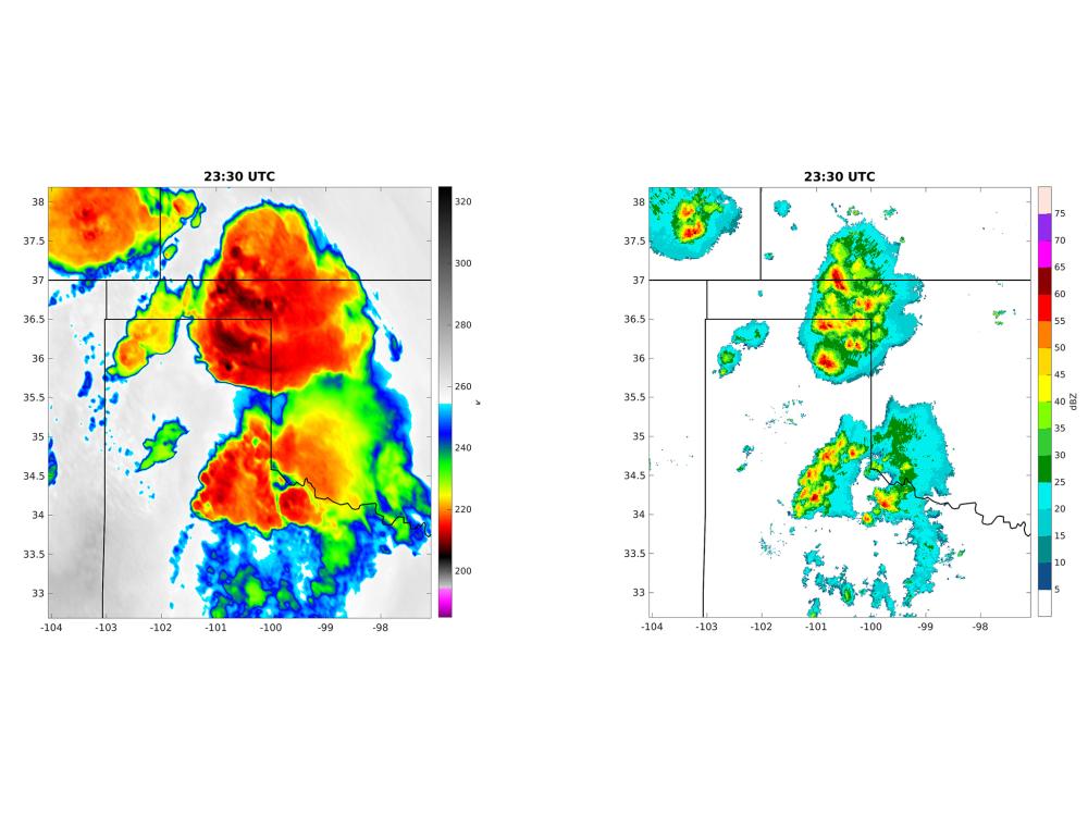
境界層と呼ばれる大気の最下層で発生する雷雨を予測するため、地上のドップラーレーダーと気象衛星GOES-16のデータを組み合わせることで、現在の天気状況を最も正確に描写し、小さな大気の変化でも予報の大きなずれを防ぐ。この組み合わせは、雷雨の条件をあらかじめいくつかの時間前により正確に予測する可能性がある。
<関連情報>
- https://www.psu.edu/news/research/story/underused-satellite-radar-data-may-improve-thunderstorm-forecasts/
- https://journals.ametsoc.org/view/journals/mwre/aop/MWR-D-22-0188.1/MWR-D-22-0188.1.xml
レーダーと全天球衛星観測による大気境界層観測の同時同化による対流開始予測の改善 Simultaneous Assimilation of Planetary Boundary Layer Observations from Radar and All-Sky Satellite Observations to Improve Forecasts of Convection Initiation
Keenan C. Eure,Paul D. Mykolajtchuk,Yunji Zhang,David J. Stensrud,Fuqing Zhang,Steven J. Greybush and Matthew R. Kumjian
Monthly Weather Review Published:12 Jan 2023
DOI:https://doi.org/10.1175/MWR-D-22-0188.1

Abstract
Accurate predictions of the location and timing of convection initiation (CI) remain a challenge, even in high-resolution convection allowing models (CAMs). Many of the processes necessary for daytime CI are rooted in the planetary boundary layer (PBL), which numerical models struggle to accurately predict. To improve ensemble forecasts of the PBL and subsequent CI forecasts in CAM ensembles, we explore the use of underused data from both the GOES-16 satellite and the national network of WSR-88D radars. The GOES-16 satellite provides observations of brightness temperature (BT) to better analyze cloud structures, while the WSR-88D radars provide PBL height estimates and clear-air radial wind velocity observations to better analyze PBL structures. The CAM uses the Advanced Research Weather Research and Forecasting (WRF-ARW) model at 3-km horizontal grid spacing. The ensemble consists of 40 members and observations are assimilated using the Gridpoint Statistical Interpolation (GSI) Ensemble Kalman Filter (EnKF) system. To evaluate the influence of each observation type on CI, conventional, WSR-88D, and GOES-16 observations are assimilated separately and jointly over a 4-h period and the resulting ensemble analyses and forecasts are compared with available observations for a CI event on 18 May 2018. Results show that the addition of the WSR-88D and GOES-16 observations improves the CI forecasts out several hours in terms of timing and location for this case.


