2023-03-08 イリノイ大学アーバナ・シャンペーン校

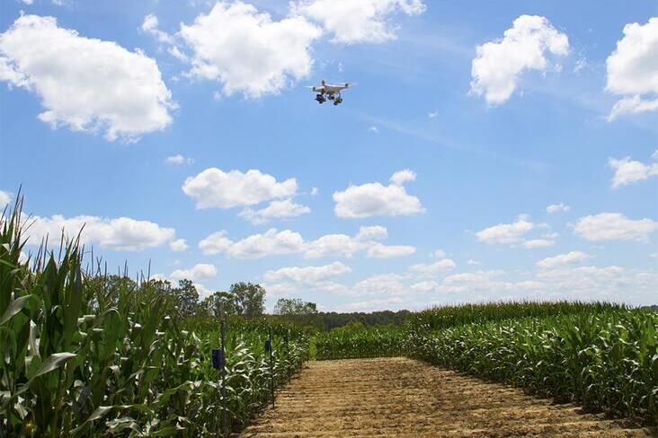
An inexpensive RGB camera attached to a drone, combined with AI deep learning, can provide valuable crop health information, a new study shows. Photo: Diane Godwin.
農作物の健康状態や収量に関する情報を提供する航空写真は、農家にとって貴重なものです。しかし、イリノイ大学とミシシッピ州立大学(MSU)の新しい研究によると、AIの深層学習と標準の赤緑青(RGB)カメラを組み合わせた写真は、高価な多色カメラによる写真と同等の作物予測ツールを、コストのほんの一部で提供することができます。RGBカメラによる航空写真からAIによる写真変換を行い、植生指数を利用して作物の健康状態をモニタリングすることが可能です。このAIソフトウェアは、追加のデータセットでネットワークをトレーニングすることにより、企業が実装または使用を拡大することができます。
<関連情報>
- https://aces.illinois.edu/news/using-standard-rgb-camera-and-ai-obtain-vegetation-data
- https://www.sciencedirect.com/science/article/abs/pii/S0168169922007049?via%3Dihub
ディープラーニングを用いた標準RGB航空画像からのNDVI/NDREの予測 NDVI/NDRE prediction from standard RGB aerial imagery using deep learning
Corey Davidson, Vishnu Jaganathan, Arun Narenthiran Sivakumar, Joby M. Prince Czarnecki, Girish Chowdhary
Computers and Electronics in Agriculture Available online:4 November 2022
DOI:https://doi.org/10.1016/j.compag.2022.107396
Abstract
The growth of precision agriculture has allowed farmers access to more data and greater efficiency for their farms. With consistently tight profit margins, farmers need ways to take advantage of the advancement of technology to lower their costs or increase their revenue. One area where these advancements can prove beneficial are in the measurement of vegetation indices such as the Normalized Difference Vegetation Index (NDVI) and Normalized Difference Red Edge Index (NDRE). Color maps representing these vegetation indices can be used to identify problem areas, plant health, or even places where spot applications are needed. These color maps help farmers to visualize these areas. Currently, a multi-thousand dollar multispectral camera, typically attached to an Unmanned Aerial Vehicle (UAV) during flight, is required for measuring these indices. This makes obtaining NDVI and NDRE somewhat cost prohibitive for most farmers. This work demonstrates a solution to this cost issue. The solution involves the use of a conditional Generative Adversarial Network known as Pix2Pix. By using Pix2Pix along with training data from UAV flights of corn, soybeans, and cotton, this paper highlights the potential for predicting comparable NDVI and NDRE with a low-cost Red-Green-Blue (RGB) camera. This paper proposes and assesses a cost-efficient method that can comparably predict these vegetation indices, resulting in cost-savings in the range of $5000 per UAV system.


