2025-04-23 NASA
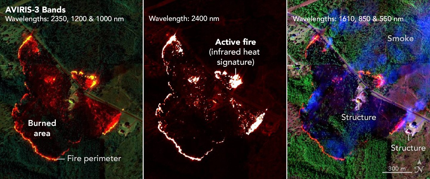
 As firefighters worked to prevent a wildfire near Perdido, Alabama, from reaching nearby buildings, they saw in an infrared fire map from NASA’s AVIRIS-3 sensor that showed the fire’s hot spot was inside its perimeter. With that intelligence, they shifted some resources to fires in nearby Mount Vernon. NASA/JPL-Caltech, NASA Earth Observatory
NASAは山火事対策として、航空機搭載型赤外線センサーによるリアルタイム観測技術を開発・運用中。ジェット推進研究所(JPL)による「c-FIRST」装置は、燃焼の強弱や進行状況を高精度で把握し、「Fire Quicklook」マップで視覚化。オレンジや赤は低温域、黄色は高温の炎を示す。これにより消防隊は迅速かつ安全に行動し、リソースの最適配置が可能に。NASAの技術は災害対応の精度と効率を大幅に向上させている。
<関連情報>


