2024-12-20 パシフィック・ノースウェスト国立研究所
<関連情報>
- https://www.pnnl.gov/publications/discrepancies-urban-land-estimates-lead-difficulties-quantifying-climate-risks
- https://www.nature.com/articles/s41467-024-52241-5
スケールを超えた都市土地の推定における大きな不一致とその影響 Large disagreements in estimates of urban land across scales and their implications
TC Chakraborty,Zander S. Venter,Matthias Demuzere,Wenfeng Zhan,Jing Gao,Lei Zhao & Yun Qian
Nature Communications Published:24 October 2024
DOI:https://doi.org/10.1038/s41467-024-52241-5

Abstract
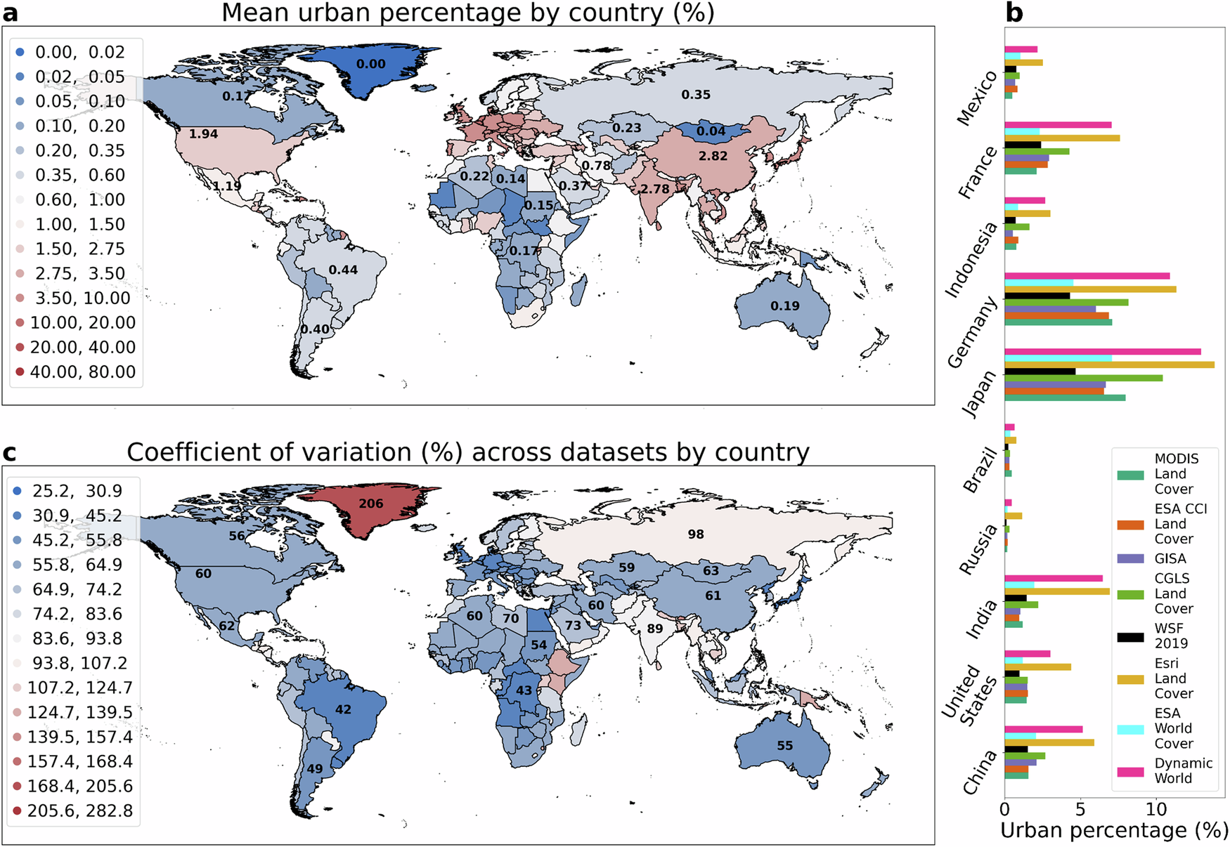
Improvements in high-resolution satellite remote sensing and computational advancements have sped up the development of global datasets that delineate urban land, crucial for understanding climate risks in our increasingly urbanizing world. Here, we analyze urban land cover patterns across spatiotemporal scales from several such current-generation products. While all the datasets show a rapidly urbanizing world, with global urban land nearly tripling between 1985 and 2015, there are substantial discrepancies in urban land area estimates among the products influenced by scale, differing urban definitions, and methodologies. We discuss the implications of these discrepancies for several use cases, including for monitoring urban climate hazards and for modeling urbanization-induced impacts on weather and climate from regional to global scales. Our results demonstrate the importance of choosing fit-for-purpose datasets for examining specific aspects of historical, present, and future urbanization with implications for sustainable development, resource allocation, and quantification of climate impacts.


