2024-12-09 オークリッジ国立研究所(ORNL)
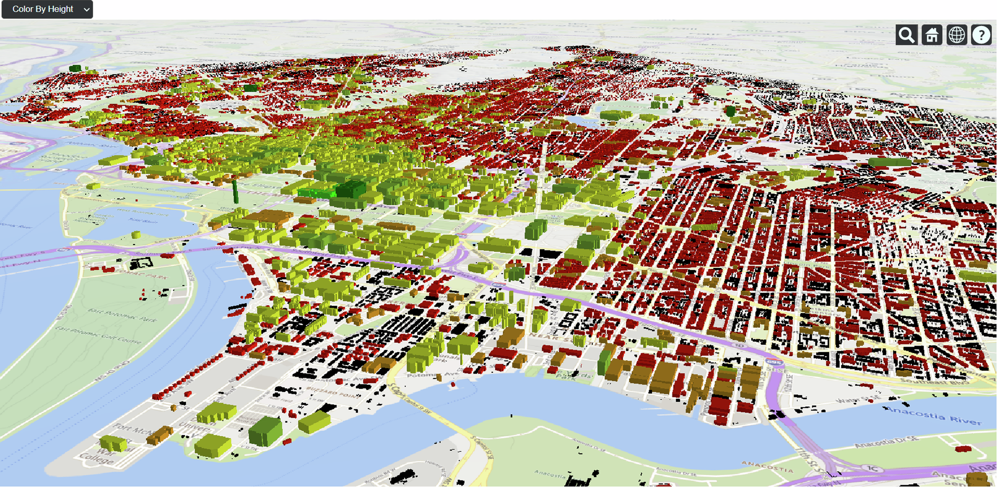
◆ORNLの研究チームは、2010年7月にワシントンD.C.で発生した熱波を対象に、この新しいモデルをテストしました。その結果、建物の存在、近接性、構造、設計に関する詳細なデータを追加することで、都市全体の温度、相対湿度、熱フラックスのモデリング精度が大幅に向上しました。特に、平均所得が最も低い地域が熱波の影響を最も強く受けることが明らかになり、これは建物データを含めなければ特定できなかったと報告されています。この研究は、都市の熱リスクを定量的に分析し、将来の都市計画や建築設計において、建物の高さ、配置、占有面積が住民に与える影響を評価するための新たな手法を提供します。
<関連情報>
- https://www.ornl.gov/news/baking-building-details-improves-urban-heat-risk-models
- https://www.nature.com/articles/s42949-024-00185-6
- https://joss.theoj.org/papers/10.21105/joss.06712
都市の形態的特徴の入力に対するメソスケールモデリングの感度と、都市の持続可能性の特徴付けへの影響 Sensitivity of mesoscale modeling to urban morphological feature inputs and implications for characterizing urban sustainability
Melissa R. Allen-Dumas,Levi T. Sweet-Breu,Christa M. Brelsford,Linying Wang,Joshua R. New & Brett C. Bass
npj Urban Sustainability Published:04 December 2024
DOI:https://doi.org/10.1038/s42949-024-00185-6

Abstract
We examine the differences in meteorological output from the Weather Research and Forecasting (WRF) model run at 270 m horizontal resolution using 10 m, 100 m and 1 km resolution 3D neighborhood morphological inputs and with no morphological inputs. We find that the spatial variability in temperature, humidity, and other meteorological variables across the city can vary with the resolution and the coverage of the 3D urban morphological input, and that larger differences occur between simulations run without 3D morphological input and those run with some type of 3D morphology. We also find that the inclusion of input-building-defined roughness length calculations would improve simulation results further. We show that these inputs produce different patterns of heat wave spatial heterogeneity across the city of Washington, DC. These findings suggest that understanding neighborhood level urban sustainability under extreme heat waves, especially for vulnerable neighborhoods, requires attention to the representation of surface terrain in numerical weather models.
naturf:数値気象モデリングのための都市パラメータ生成パッケージ naturf: a package for generating urban parameters for numerical weather modeling
Levi T. Sweet-Breu, Em Rexer, Chris R. Vernon, Melissa R. Allen-Dumas, and Stefan Krawczyk
Journal of Open Source Software Published 06 June 2024
DOI:https://doi.org/10.21105/joss.06712

Summary
The Neighborhood Adaptive Tissues for Urban Resilience Futures tool (NATURF) is a Python workflow that generates files readable by the Weather Research and Forecasting (WRF) model. NATURF uses geopandas (Jordahl et al., 2020) and hamilton (Krawczyk & Izzy, 2022) to calculate 132 building parameters from shapefiles with building footprint and height information. These parameters can be collected and used in many formats, and the primary output is a binary file configured for input to WRF. This workflow is a flexible adaptation of the National/World Urban Database and Access Portal Tool (NUDAPT/WUDAPT) (Ching et al., 2009; Mills et al., 2015) that can be used with any study area at any spatial resolution. The climate modeling community and urban planners can identify the effects of building/neighborhood morphology on the microclimate using the urban parameters and WRF-readable files produced by NATURF. More information on the urban parameters calculated can be found in the documentation.


