2025-07-03 コペンハーゲン大学(UCPH)
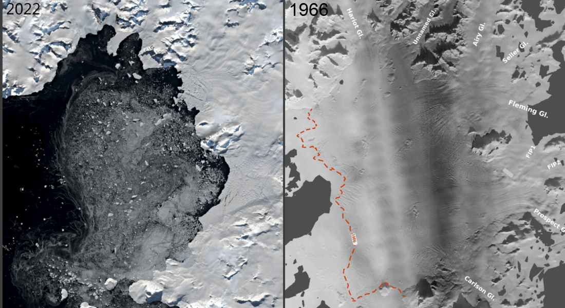
 The Wordie Ice Shelf has undergone a total collapse since first photographed november 1966. Image: Mads Dømgaard
<関連情報>
- https://news.ku.dk/all_news/2025/07/old-aerial-photos-give-scientists-a-new-tool-to-predict-sea-level-rise/
- https://www.nature.com/articles/s41467-025-59293-1
ワーディー棚氷の海洋駆動型崩壊に伴う動的不安定性の半世紀 Half a century of dynamic instability following the ocean-driven break-up of Wordie Ice Shelf
Mads Dømgaard,Romain Millan,Jonas K. Andersen,Bernd Scheuchl,Eric Rignot,Maaike Izeboud,Maud Bernat & Anders A. Bjørk
Nature Communications Published:29 April 2025
DOI:https://doi.org/10.1038/s41467-025-59293-1
Abstract
Ice shelves restrain grounded ice discharge into the ocean, and their break-up contributes significantly to Antarctica’s sea level rise. Using aerial imagery from the 1960s and modern satellite data, we construct a long-term record of Wordie Ice Shelf’s disintegration and its effects on tributary glaciers. Early changes in pinning points and ocean warming in Marguerite Bay since the 1960s strongly suggest increasing basal melt as the primary driver of the ice shelf disintegration. Some glaciers responded immediately to the ice shelf break-up, with surface velocities tripling, thinning up to 160 m, and grounding line retreat of 7.5 km, while others reacted decades later due to buttressing from remnant parts of the ice shelf. Our findings emphasize the importance of long-term observations to understand ice shelf disintegration and its impacts, offering crucial insights for assessments of future ice loss from the Antarctic Ice Sheet.


