2024-08-06 エディンバラ大学
<関連情報>
- https://www.ed.ac.uk/news/2024/antarctic-survey-of-plant-life-to-aid-conservation
- https://www.nature.com/articles/s41561-024-01492-4
南極全域の光合成生物に関する衛星由来のベースライン A satellite-derived baseline of photosynthetic life across Antarctica
Charlotte V. Walshaw,Andrew Gray,Peter T. Fretwell,Peter Convey,Matthew P. Davey,Joanne S. Johnson & Claudia Colesie
Nature Geoscience Published:06 August 2024
DOI:https://doi.org/10.1038/s41561-024-01492-4

Abstract
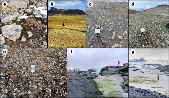
Terrestrial vegetation communities across Antarctica are characteristically sparse, presenting a challenge for mapping their occurrence using remote sensing at the continent scale. At present there is no continent-wide baseline record of Antarctic vegetation, and large-scale area estimates remain unquantified. With local vegetation distribution shifts now apparent and further predicted in response to environmental change across Antarctica, it is critical to establish a baseline to document these changes. Here we present a 10 m-resolution map of photosynthetic life in terrestrial and cryospheric habitats across the entire Antarctic continent, maritime archipelagos and islands south of 60° S. Using Sentinel-2 imagery (2017–2023) and spectral indices, we detected terrestrial green vegetation (vascular plants, bryophytes, green algae) and lichens across ice-free areas, and cryospheric green snow algae across coastal snowpacks. The detected vegetation occupies a total area of 44.2 km2, with over half contained in the South Shetland Islands, altogether contributing just 0.12% of the total ice-free area included in the analysis. Due to methodological constraints, dark-coloured lichens and cyanobacterial mats were excluded from the study. This vegetation map improves the geospatial data available for vegetation across Antarctica, and provides a tool for future conservation planning and large-scale biogeographic assessments.


