2024-09-10 オークリッジ国立研究所(ORNL)
<関連情報>
- https://www.ornl.gov/news/driving-smart-infrastructure
- https://www.mdpi.com/1424-8220/24/7/2327
- https://ieeexplore.ieee.org/document/9967036
自動レーンセンタリング: 既製のコンピューター・ビジョン製品とインフラベースのチップ式舗装標識の比較 Automated Lane Centering: An Off-the-Shelf Computer Vision Product vs. Infrastructure-Based Chip-Enabled Raised Pavement Markers
Parth Kadav,Sachin Sharma,Johan Fanas Rojas,Pritesh Patil,Chieh (Ross) Wang,,Ali Riza Ekti,,Richard T. Meyer andZachary D. Asher
Sensors Published: 5 April 2024
DOI:https://doi.org/10.3390/s24072327

Abstract
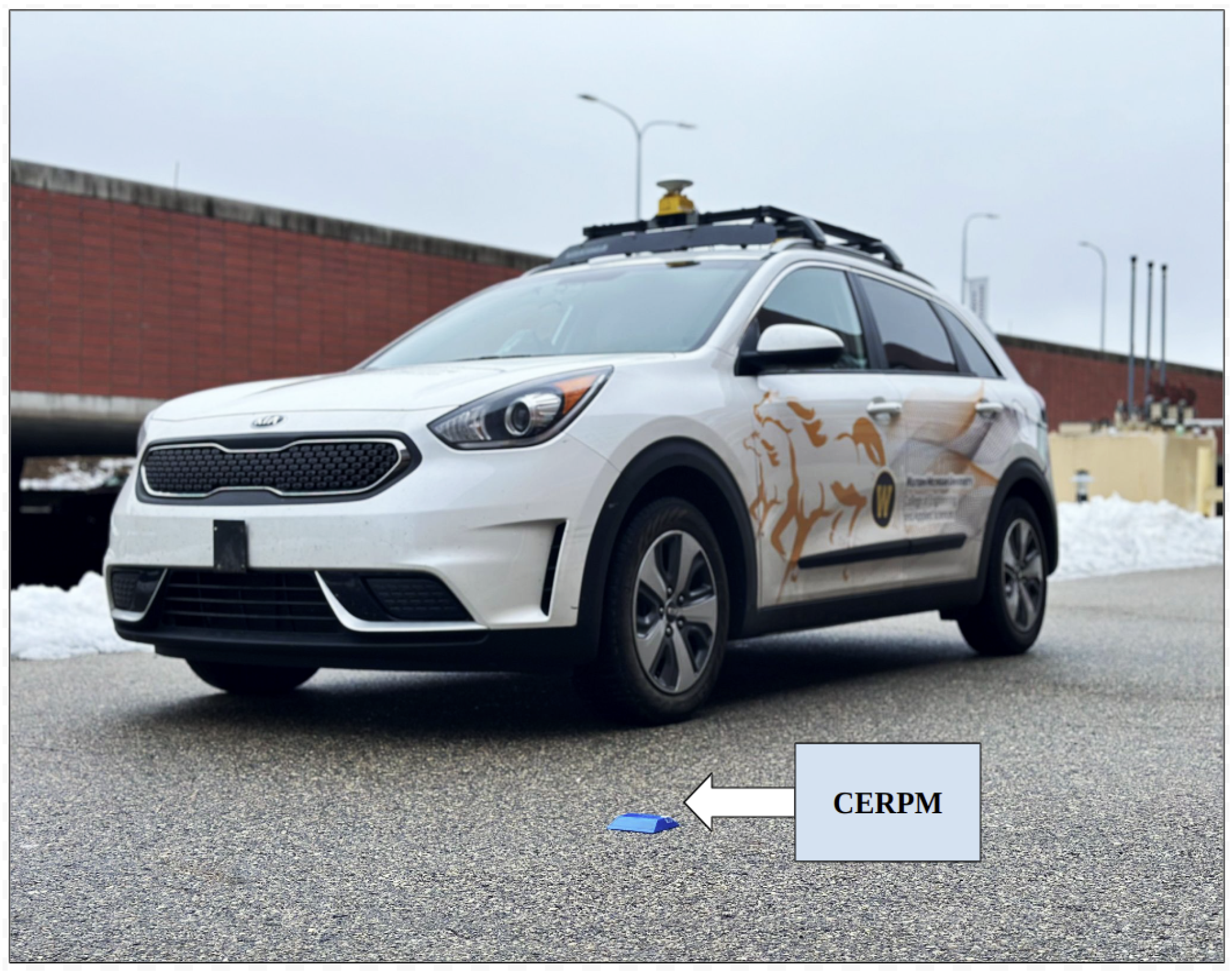
Safe autonomous vehicle (AV) operations depend on an accurate perception of the driving environment, which necessitates the use of a variety of sensors. Computational algorithms must then process all of this sensor data, which typically results in a high on-vehicle computational load. For example, existing lane markings are designed for human drivers, can fade over time, and can be contradictory in construction zones, which require specialized sensing and computational processing in an AV. But, this standard process can be avoided if the lane information is simply transmitted directly to the AV. High definition maps and road side units (RSUs) can be used for direct data transmission to the AV, but can be prohibitively expensive to establish and maintain. Additionally, to ensure robust and safe AV operations, more redundancy is beneficial. A cost-effective and passive solution is essential to address this need effectively. In this research, we propose a new infrastructure information source (IIS), chip-enabled raised pavement markers (CERPMs), which provide environmental data to the AV while also decreasing the AV compute load and the associated increase in vehicle energy use. CERPMs are installed in place of traditional ubiquitous raised pavement markers along road lane lines to transmit geospatial information along with the speed limit using long range wide area network (LoRaWAN) protocol directly to nearby vehicles. This information is then compared to the Mobileye commercial off-the-shelf traditional system that uses computer vision processing of lane markings. Our perception subsystem processes the raw data from both CEPRMs and Mobileye to generate a viable path required for a lane centering (LC) application. To evaluate the detection performance of both systems, we consider three test routes with varying conditions. Our results show that the Mobileye system failed to detect lane markings when the road curvature exceeded ±0.016<?XML:NAMESPACE PREFIX = “[default] http://www.w3.org/1998/Math/MathML” NS = “http://www.w3.org/1998/Math/MathML” />±0.016 m−1. For the steep curvature test scenario, it could only detect lane markings on both sides of the road for just 6.7% of the given test route. On the other hand, the CERPMs transmit the programmed geospatial information to the perception subsystem on the vehicle to generate a reference trajectory required for vehicle control. The CERPMs successfully generated the reference trajectory for vehicle control in all test scenarios. Moreover, the CERPMs can be detected up to 340 m from the vehicle’s position. Our overall conclusion is that CERPM technology is viable and that it has the potential to address the operational robustness and energy efficiency concerns plaguing the current generation of AVs.
レーンライン検出用チップ対応レイズド舗装マーカーの開発と評価 Development and Evaluation of Chip-Enabled Raised Pavement Markers for Lane Line Detection
Sachin Sharma; Ali Riza Ekti; Johan F. Rojas; Nicolas E.…
2022 IEEE Sensors Date Added to IEEE Xplore: 08 December 2022
DOI:https://doi.org/10.1109/SENSORS52175.2022.9967036
Abstract
Increased energy consumption from autonomous vehicle (AV) sensors and computational load as well as upfront costs of sensors are barriers to broad AV adoption. For high quality and reliable perception of the driving environment, incoming data from multiple sensors need to be fused together using advanced computational algorithms, which requires a high compute load. As an alternative, infrastructure-based sensors can be designed to facilitate perception and sensing by supporting vehicle-to-infrastructure (V2I) information exchange. This work presents the initial development and evaluation of a novel energy efficient infrastructure-based sensor. The sensor, a chip-enabled raised pavement marker (CERPM), is capable of wireless communications to exchange environment information with AVs. As a test case, the developed CERPM is applied in real-world driving to perform lane line and drivable region detection for an AV. It is shown that CERPMs can be utilized to effectively detect the lane line and drivable region, which can improve perception while reducing the compute load.


